Cargando...
Recursos educativos
-
Nivel educativo
-
Competencias
-
Tipología
-
Idioma
-
Tipo de medio
-
Tipo de actividad
-
Destinatarios
-
Tipo de audiencia
-
Creador
Lo más buscado
- Repaso de la multiplicación
- Proyectos de ciencia
- Globoflexia
- Los ríos
- Aprender a multiplicar
- Rios de África
- Aprender a vestirse
- Funciones
- Gustavo Adolfo Bécquer
- Imprimir lecturas comprensivas
- Divisiones decimales
- Actividades de dibujos para niños
- Experimentos con globos
- Martin Luther King
- Teoría del arte
-

Interpret. Allied victories
EduBook Organización
- 799 visitas
Make a time line to show the stages of the Allied forces' main offensives.
-

Self-assessment T7 05 - The 20th century and the world today
EduBook Organización
- 724 visitas
What characteristics of the 20th century do these pictures show us?
-
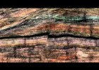
Big Idea 3: Earth's Systems Interact
V&V Books Vicens Vives Organización
- 914 visitas
Observe the events that show how Earth works as a set of interconnected systems.
-

Comprehension (III)
EduBook Organización
- 753 visitas
Complete the chart below to show what the Struldbruggs are really like.
-

Comprehension (IV)
EduBook Organización
- 686 visitas
Complete the chart below to show some of the projects that Gulliver sees in the Academy.
-
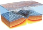
Explosive volcanism drove major changes in Snowball Earth ocean chemistry
Cristina Seco Organización
- 683 visitas
This website discusses findings that show how volcanoes helped to end the Snowball Earth.
-

Madrid is also nature
V&V Books Vicens Vives Organización
- 543 visitas
In spring and autumn, the most beautiful landscapes and places. A real show!
-

Representing the Earth
EduBook Organización
- 2498 visitas
Globes and maps We use globes and maps to show what the Earth looks like. Globes show the Earth as a sphere. They show the true shape of the Earth and its tilt. They also show the positions of oceans…
-

Voicethread tutorial (for students)
Tiching explorer Organización
- 2444 visitas
Video that show us how to register and use Voicethread application. VoiceThread is a collaborative, multimedia slide show that holds images, documents, and videos and allows us to navigate slides and…
-
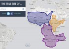
The true size of countries (Mercator map projection)
Cristina Seco Organización
- 1 lo usan
- 7765 visitas
An interactive resource which uses the Mercator map projection to show the true size of different countries.
Te estamos redirigiendo a la ficha del libro...


